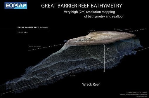
For the first time, a complete bathymetry high resolution (30 meters) bathymetry map is available of the Great Barrier Reef.
from Geoprocessing | Scoop.it http://www.scoop.it/t/geoprocessamento/p/4012229305/2013/12/05/satellite-mapping-of-the-great-barrier-reef-gis-lounge
via IFTTT
Nenhum comentário:
Postar um comentário