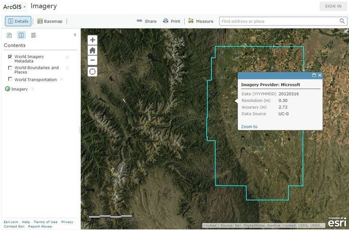
Considering the vintage, or date, when satellite or aerial imagery was acquired is essential information in investigating land use, vegetation health, or any other variable using GIS and Remote Sensing technologies.
from Geoprocessing | Scoop.it http://www.scoop.it/t/geoprocessamento/p/4013716876/2014/01/06/considering-the-vintage-of-imagery-in-analyzing-the-earth
via IFTTT
Nenhum comentário:
Postar um comentário